|
Saturday,
June 18, 2005
Off we go to the edge of the continental United States - Cape Flattery near Neah Bay. It's a wonderful drive, along the Strait of Juan De Fuca and a pleasant hike out to the end of the Cape. |
|||
 |
|
||
|
|
|||
 |
Tim and I took the ferry from Edmonds to Kingston and drove north through Sequim and Port Angeles to Rte 112 which took us along the shore of the Strait of Juan De Fuca to Neah Bay. We were observed. |
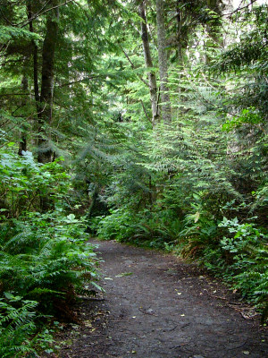 |
From Neah Bay we headed northwest to Cape Flattery. The rain was holding off, so we loaded ourselves up with cameras, tripods and lunch and headed off down this deceptive path. It's a nice downhill walk all the way to the lookout at the end of the Cape. Who thinks about the walk back? Heh! |
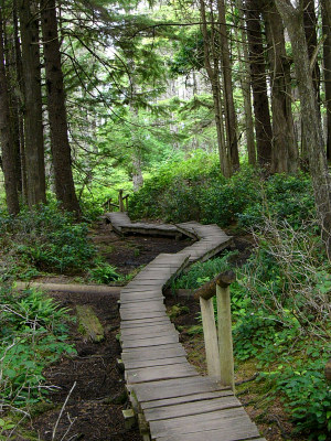 |
The trail is kept in good shape by the Makah Indians. There are boardwalks over the swampy bits, and stairs and handrails on the steeper hilly parts. Yes, we're still going downhill. :) |
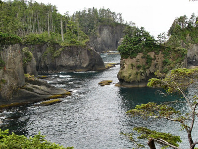 |
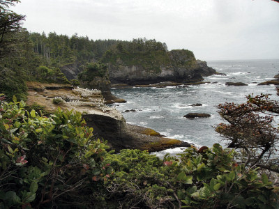
Here we are at the first lookout. This is one of the inlets. The air is alive with the sounds of gulls. That's the Pacific Ocean! |
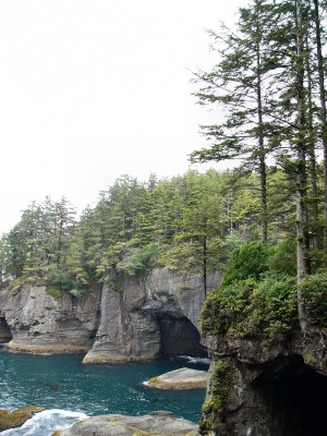 |
A little further on the other side of the trail is another lookout, high over a bay lined with caves. They are magnificent. |
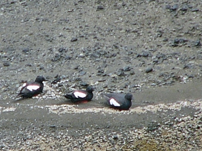 |
Sadly there were many folks fishing in the area today, and the birds were somewhat scarce. On the left of the cave in the center of the previous photo were three Pigeon Guillemots. There's a large nesting colony of Guillemots here. |
 |
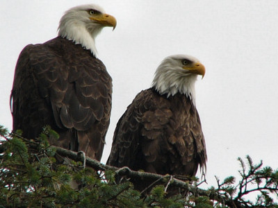
We're almost at the end now. The little white dots on the rocks are hundreds and hundreds of gulls. Periodically we are warned of the approach of a Bald Eagle when the screaming of the gulls reaches a crescendo and there is a mass exodus from the rocks. |
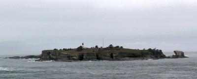 |
Straight across the water from the final lookout is Tatoosh Island with its lighthouse. |
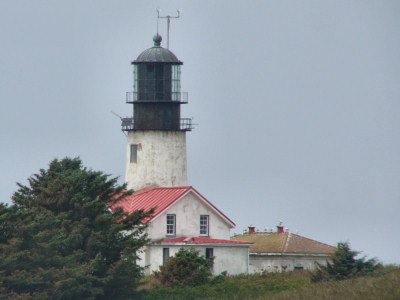 |
Here's a closeup of the lighthouse on the island. Tatoosh Island was a former Makah fishing and whaling camp and more recently a Coast Guard station. |
| Pictures: Page One Two |